![]()
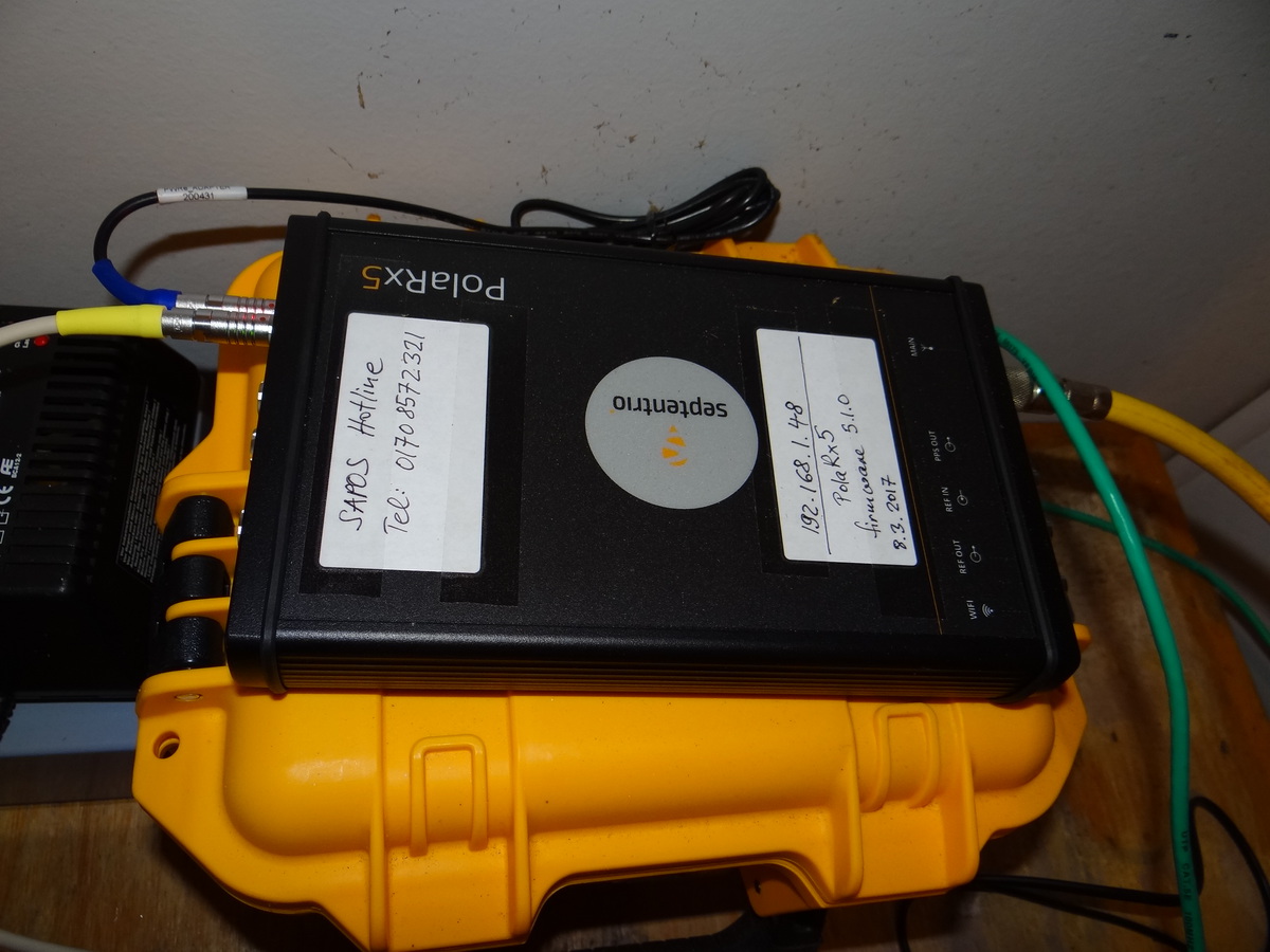
Since 8.3.2017 the receiver is a Septentrio PolaRx5 (SN: 4501521) with firmware Rev. 5.1.0
The antenna is a SEPCHOKE_B3E6 SPKE choke ring antenna also from Septentrio.
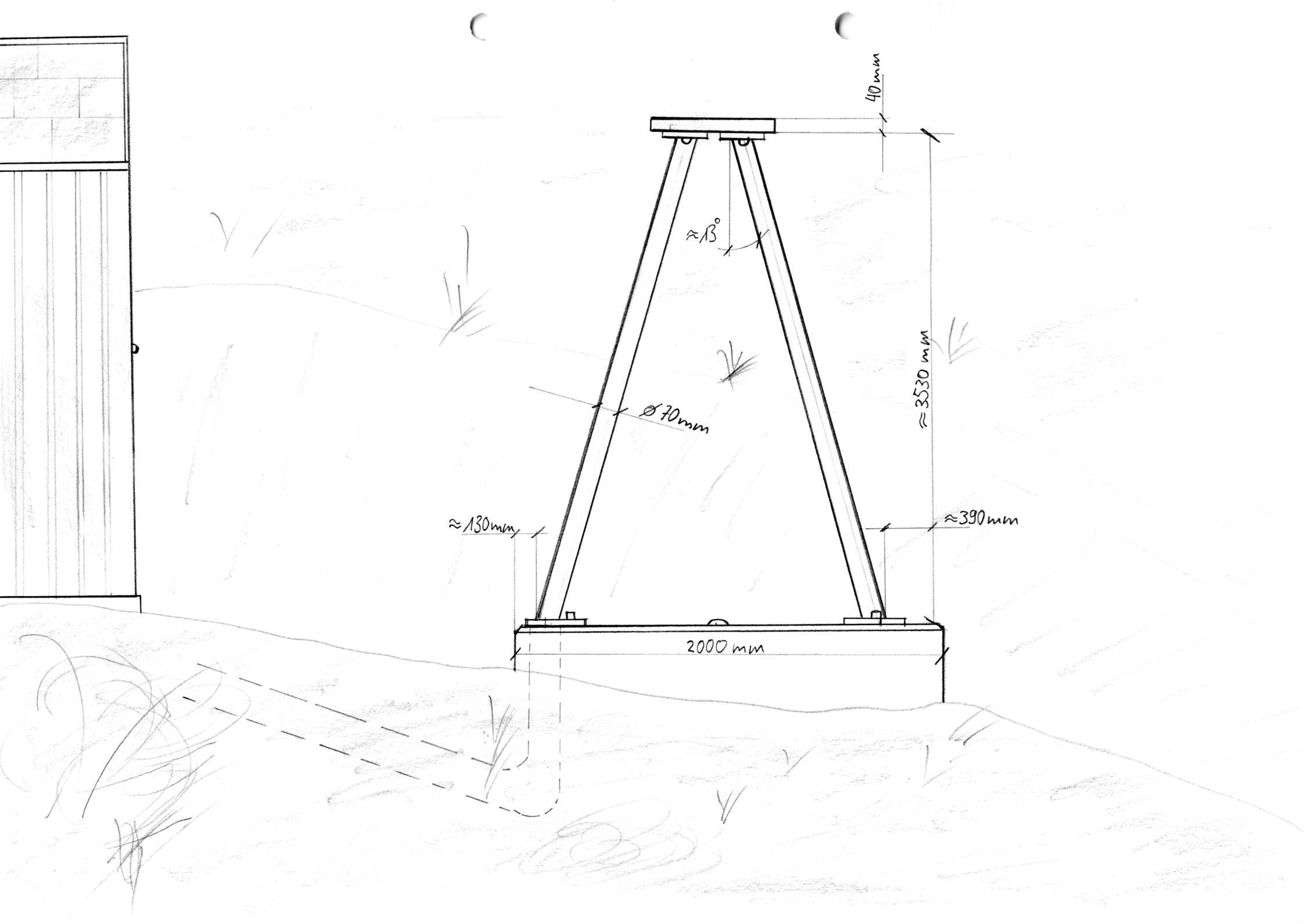
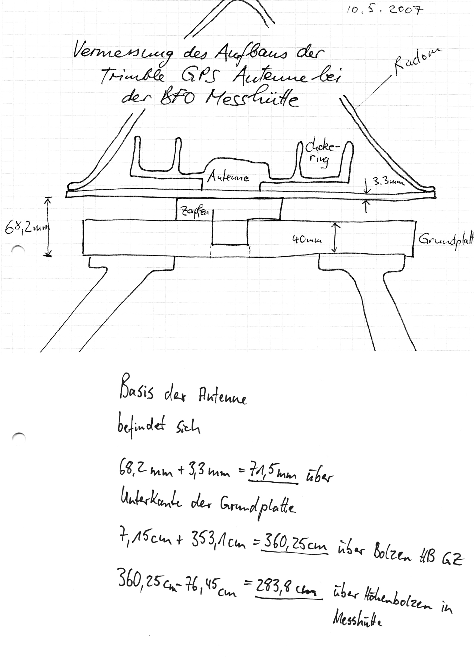
The relevant dimensions of the antenna are documented here and for the antenna tripod here and here.
The height of the antenna relative to a geodetic/gravimetric height marker inside the magnetics hut has been determined in april/may 2007.
No phase calibration is available for the current antenna.
A phase calibration of the previously installed Trimble antenna including its Radome was carried out in spring of 2008 bey Geo++ in Hannover. The results are documented here.
![]()
Rinex data can be accessed via anonymous ftp from here.
To fully document the setting of BFO1 we are about to fill in an IGS type station log.
![]()
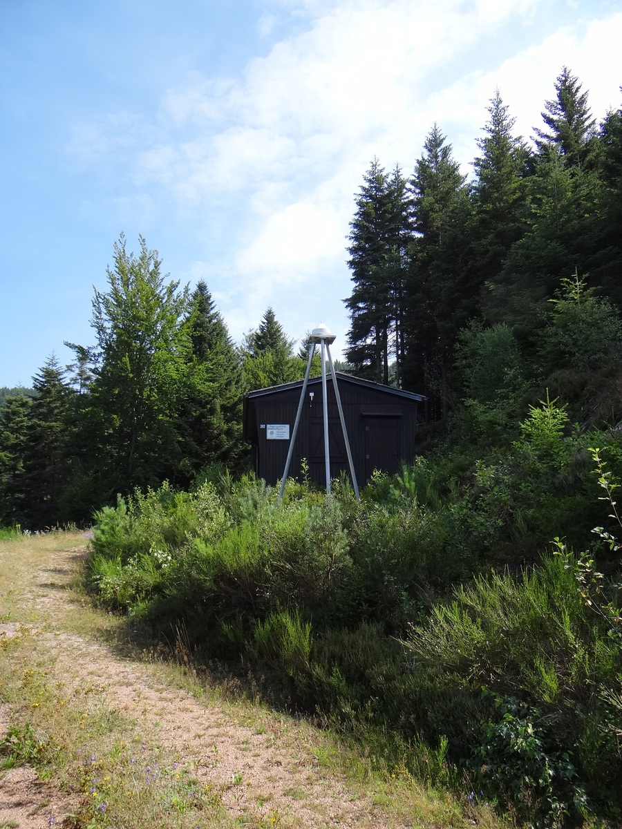
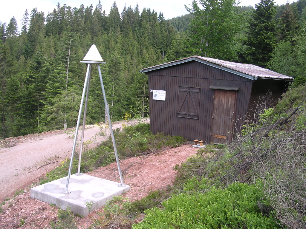
View from the South-West showing the magnetics hut
and the GPS antenna of BFO1.
![]()
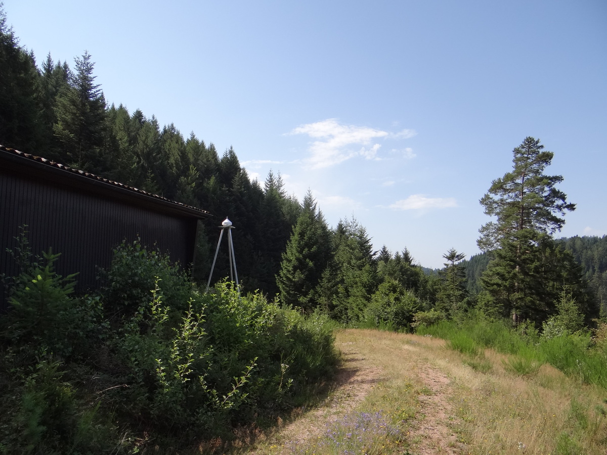
View from the North-West showing the magnetics hut
and the GPS antenna of BFO1.
![]()
This is  BFO1. Close-up view of the Tripod with the old (pre-2017) Trimble antenna.
The height of the tripod has
been chosen to match the height of the magnetics hut.
![]()
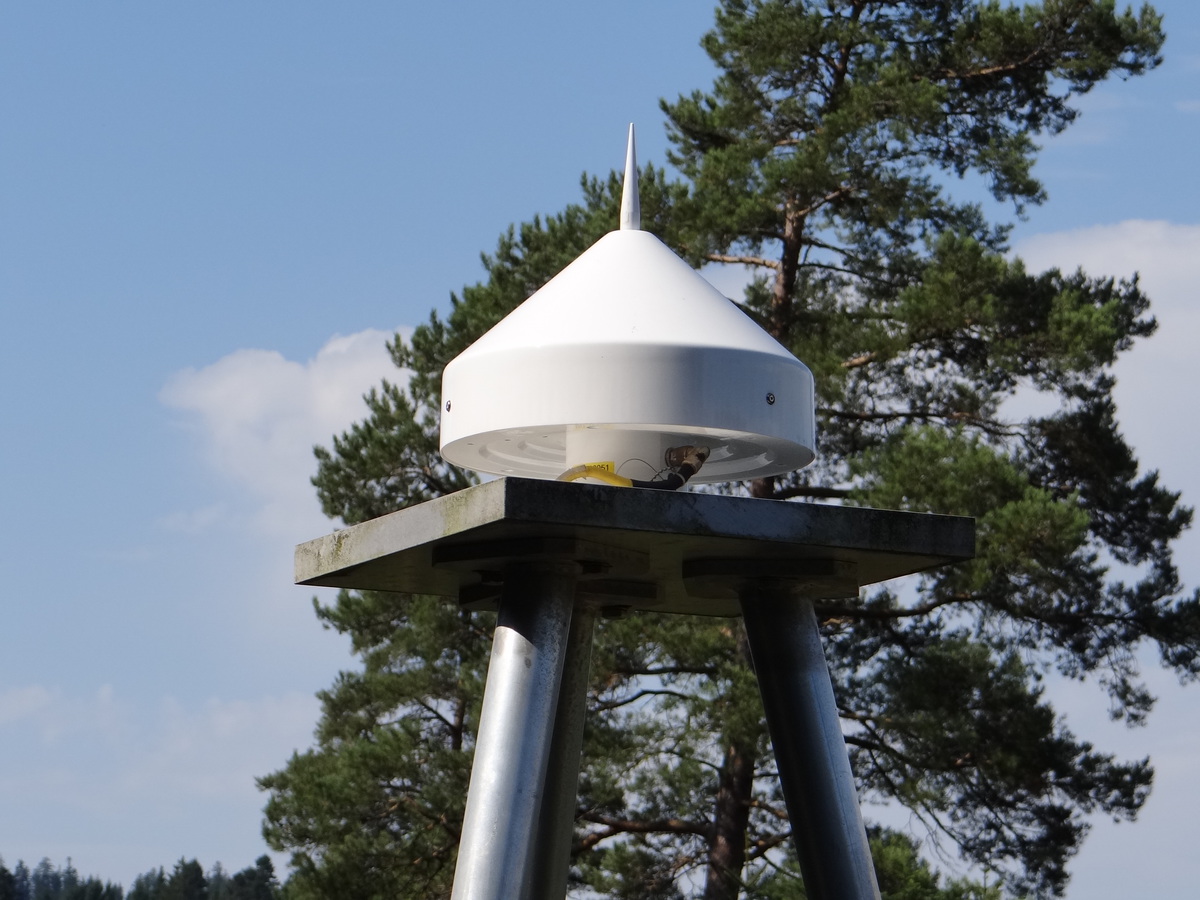
Close-up view of the Septentrio Choke Ring Antenna.
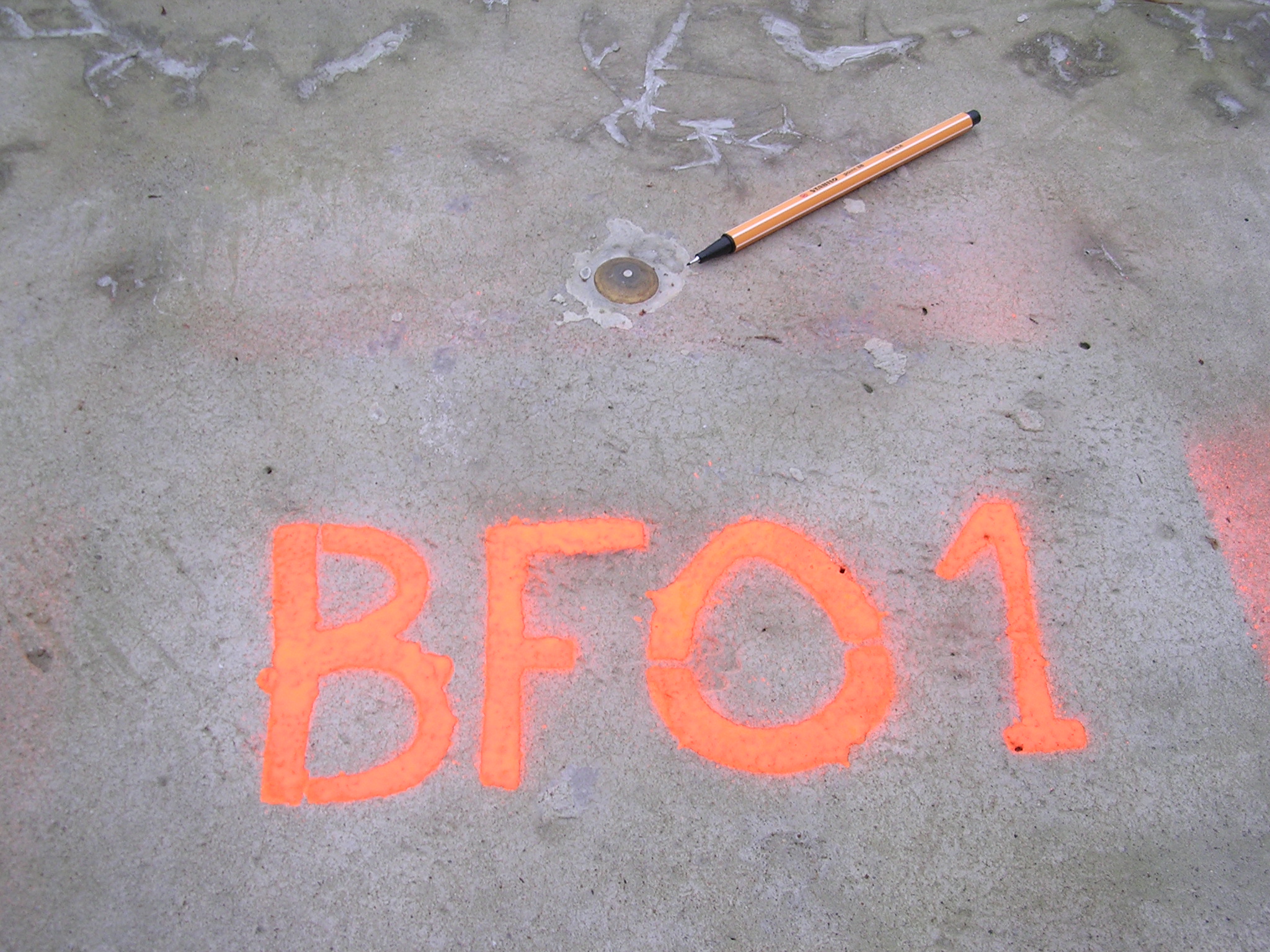
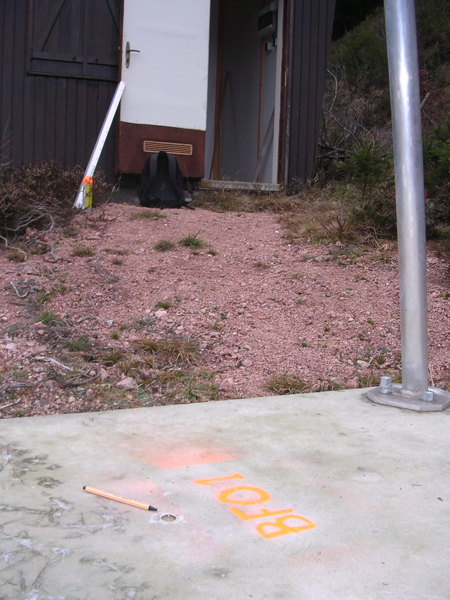
The brass nail defining BFO1.
![]()
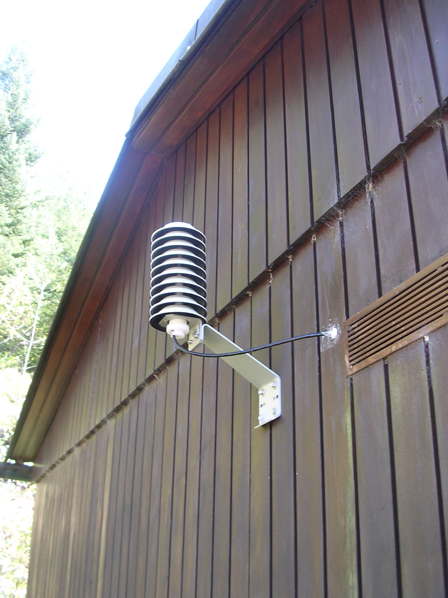
The Vaisala temperature and humidity sensor mounted on the north wall of
the magnetics hut. Here it gets very little direct light from the sun.

![]()
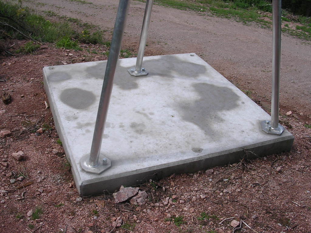
The 2m by 2m concrete foundation with the tiny geodetic marker underneath
the antenna. The pier sits on slightly weathered granite which was
excavated to a depth of 1m below the surface.
![]()
The Septentrio PolaRx5 receiver is located inside the magnetics hut. Next
to it we operate a Paroscientific microbarometer model 6000-16B. Data
from both these sensors and the Vaisala HMT330 are transmitted over a
fiber optic link to the main laboratory building.
![]()